
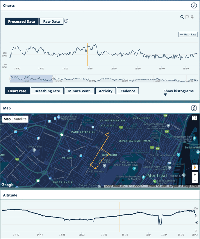
When using the Hexoskin mobile app, GPS information is taken from your phone and saved with your Run and Cycle activities only (for more details, refer to this link). After completing the activity and syncing your data, a map will be displayed to show the route you just completed on your Dashboard.
You will be able to track simultaneously your metrics (in the Charts section) along with the altitude over your itinerary by moving your mouse cursor along your cycling route or your run on the map.
Please note that GPS data from your phone will only be taken into account if you are carrying your phone with you (with the Hexoskin App turned on) during a cycling or run activity only and if you have granted the Hexoskin app access to your phone's GPS (for more details, refer to this link).
GPS data is collected only if you are using the mobile app to tag your cycling or running activity. Please note that it is not possible to calculate the distance travelled and generate a map of your route on a past record.
Please note also that GPS data cannot be collected for stationary biking or track racing.